
7f Suttons Lane, Hornchurch, Essex, RM12 6RD (Show me directions) Show Map
Profile
Welcome
LRM Survey Services Ltd provides a range of services from Topographical to Measured Building surveys.
About Us
Whether you are looking for simple measured plans for the initial inception of a scheme or a complete record of every feature for development schemes we can help.
Services
The areas of expertise are:
· Floor plans
· Sections
· Elevations
· Level surveys
· Topographical surveys
· Lease plans
· Setting out
· As built surveys
· Services and drainage details
· CAD drafting and plotting
All surveys are plotted in AutoCAD and are issued in digital format (full colour paper copies can be supplied upon request).
Lease Plans
Since October 2003 all new leases of over 7 years, or existing leases sold with 7 years or more unexpired lease must now be registered with the Land Registry. This must include a compliant Lease Plan.
This service is usually required by private landlords, law firms and investment companies.
A basic measured survey is required in order to produce floor plans of the areas in question, the plans will then be drawn up to a relevant scale and a OS plan attached to show the location of the property.
Turnaround for this particular service is usually within two days of survey commencement.
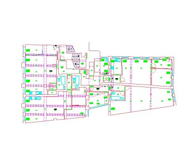
Measured Building Surveys
LRM Survey Services Ltd carries out measured building surveys for a wide verity of applications.
These typically include Floor Plans, Sections and Elevations.
We have experience in producing plans ranging from terraced house to retail units all of which can be produced to the level of detail required.
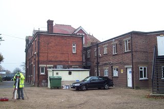
Our surveys are produced using a combination of hand-held Leica Laser Measure and Leica 1200 seris EDM's coupled via 'Bluetooth' technology to a hand-held Tablet.
This approach, which produces the CAD drawing during the survey process, allows us to establish and accurately check all building dimensions while on site. A precision of ± 5mm over 100 metres is achievable with this equipment - giving a normal working accuracy of ± 25mm between any two points after building tolerances have been taken into account.